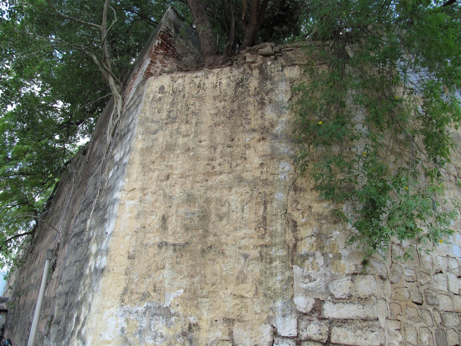
UKKIRANKOTTAI - In search of the roots
of the roots:
For a long time I am enchanted with the pieces of historic
information about King Ukkira Pandya who built the Sankaranainar Temple at
Sankarankoil of Tirunelveli District.
It was a ‘karna paramparai’ information [word of
mouth passed over to generations – may I call it the ‘folk history’ of the locality?] that the devoted king, who still stands as a life
size statute in the inner precincts of Sankarankoil temple in a worshipping
form, before our lord Sankara Nainaar, that he arranged the bricks required for
the temple construction brought from his township Ukkirankottai, by passing
through a human chain of his men covering a distance of about 33 kms.
King Ukkira pandya who probably ruled the North
Western part of Nellai Cheemai, in the 11th Century from
Ukkirankottai used to visit Madurai frequently through the present Sankarankoil
tract which was once a forest of auspicious ‘punnai’ trees as per the ‘sthala
puranam’ i.e. the temple township history. During one such journey, through the
above forest, the royal elephant suddenly became unruly and eventually tumbled into
a pit. At that time the king was
informed by a forest watch man, that he had just found an unusually strong
and radiant cobra in an anthill that he removed inside the forest. Perturbed by
the combination of the above events, the King visited the spot accompanied by the
watch man and saw a shiva lingam in the anthill. On the oracle that he received
at that moment, the king embarked on the mission of constructing a grand temple
for lord Shiva there.
 |
| SANKARA NAINAAR TEMPLE |
The temple history says that King Ukkirapandiya
completed the core of the temple and one of his late successors, King Veeraseevala
mara Pandya further developed the temple precincts and accomplished the
construction of outer walls and the magnificent Raja Gopuram which is one of
the few majestic Raja Gopurams towering into the skies of Nellai cheemai. Other
magnificent Rajagopurams studding our land are at Tirunelveli, Tenkasi,
Tiruchendur, Tirupudaimarudhur, Brahmmadesam and Papanasam. King Veeraseevala
mara pandya was said to be guided by the then pontiff of Thiruvavaduthurai Mutt.
Sankarankoil temple is a ‘Prithvi sthalam’ i.e. representing the
Earth among the ‘pancha bootha shetrams’ – five shetrams representing the
elements – the remaining temples are at Dhaarugapuram, Dhevathaanam, Thenmalai
and Karivalamvanthanallur in the nearby localities.
Punnai, a Southern peninsular tree is
the ‘sthala vrisham’ i.e. the revered and auspicious tree of the temple and the
locality. The earth ceremoniously brought to the temple from the ancient Punnai
forestry which was in the South Western part of the present town is considered
as an auspicious ‘prasaad’ having curative properties by the devotees. Punnai
tree has surprisingly
similar rhyming names in other languages also – ‘punnang’ in Bengali and ‘bunga’ in Malay. In
Sanskrit it is ‘punnaga’ or ‘nagachampa’.
11th Century - the time of Ukkirapandya - is the period
when the Pandya Army was completely subjugated by the emerging Chola military
might, heralding the meteoric rise of the Later Chola Dynasty with the spade
work laid by Emperor Paraanthaga Chola. From the position of King Ukkirapandya
it can be surmised that even at the time of fallen glory, the Pandya hinterlands
were never conquered by the Cholas. Hence the Cholas could not cast their sway
beyond Madurai at that time. It can be assumed that the King Ukkirapandya
should be a vassal of the Pandya ruling dynasty of Madurai.
Website of ASI-Archeological
survey of India informs that they conducted excavations in Ukkirankottai, way
back in 1970-71. But I don’t know how to access the documentation of the
resultant findings arrived. I had a
long time curiosity to visit Ukkirannkottai, named after this competent King
Ukkira Pandya.
Ukkirankottai by its very name suggests a walled area in the
name of the King Ukkira Pandya. The Sanskrit meaning of the term ‘ugra’ is ‘fierce’.
Ukkirankottai is now just a
small township, 36 kms away from
Tirunelveli, on the Northern banks of ‘Chitraru’, one of the two major tributaries
of river Tamiraparani. I noticed a clearly discernible circular feature in the
wikimapia satellite image of Ukkirankottai which kindled my interest further. One
of my friends, Kannan, a welder and steel furniture maker by profession
enthusiastically volunteered to accompany me.
We first visited the Shiva temple at Ukkirankottai. Curiously
this temple priest is a vaishnavite. The resourceful priest confirmed the karna-parampara
information about the bricks passed by way of a human chain upto Sankarankoil
by king Ukkirapandya.
Other related information that are still in the realm
of folk lore memory, we came to know are that Kalakkudi, a fertile village on
the southern banks of Chitraru just opposite to Ukkirankottai was only the ‘naadu’
or regional centre, though the political seat of power was at Ukkirankottai;
that Ukkirankottai was originally known as ‘Karavantha puram’ before it was
named after the King Ukkira Pandya. The 12th check dam across the Chitraaru
River is colloquially referred as ‘kadappurathu anai’. 'Kadappuram' is a broken
word from 'Karavanthapuram'. The king had two wise councilors, Saathan Ganapathy
and Maran Ganapathy hailing from Kalakkudi; that they were brothers and from ‘maruthuvar’
community. They were said to be closely associated with Anaimalai locality in
Madurai. It is evident that in the ancient Tamil country merit was considered over the background of a person.
In the outskirts of the town, to our surprise and
chill we found a circularly formed ancient ‘agali’ structure ['moats' i.e. defensive channel running around a fortification] still noticeably intact. We were actually
thrilled to see the enormous breadth and depth of this nearly 900 years old ‘agali’!
However there was no trace of the ancient walls for locating which elaborate
excavations may be required. Though the ‘agali’ structure is still discernible it is almost in
the course of its fast disappearance.
The agali is somewhat perfectly circular in shape
running around Ukkirankottai Township. However to my disappointment, diameter of
the circular area formed by the agali spans approximately to one km only,
suggesting only a smaller fortification than what I expected. About two thirds
of the Eastern parts of the encircled area is now of paddy fields. The residential
quarters are at the southern most corner portion of this encircled area of the
present township. Considering the topography of the Western parts of the
encircled area with mounds and the two thirds part of the encircled area in the
East under agro cultivation, there is a fair possibility of finding ancient
structures if selective excavations are carried out in these locations. The
bulk of the present township being outside this agali structure also
strengthens this observation.
Almost at the centre of this circular formation there
exists a mound with scattered ruins of an ancient temple. Amidst the ruins, few
shattered brick work structures alone are found. There are no stone structures
left out. Local people told us that was the place where the Shiva temple originally
existed. During the British period the British rulers said to have taken away
the stone structures of the temple and used them to strengthen the two ancient
diversion barrages existed across the River Chitraaru.
One such barrage structure is across Ukkirankottai -
Kalakkudi which is the 13th barrage across river Chitraru under the
maintenance of the State PWD and the other one is at Western ‘Vaal Veechu
Rastha’ [ this is 12th barrage across the river from its origin
point]. These barrages are part of the ancient irrigation systems helping to
divert the seasonal flood waters from the river to irrigation tanks of the
region. However the agali is said to be watered in olden days by two other nearby
tanks in the West which we have not visited.
The present shiva temple located at the Southern part
of the circular agali feature was said to be a vaishnavite shrine later changed
into a saivite temple after the dilapidation of the original temple. The
Vaisnavite shrine ‘vigrahas’ [idols] were said to be trans-located to another
vaishnavite shrine at nearby Rediyarpatti village. One could see numerous
ruined temple idols in this temple. We were able to spot several damaged idols
/ sculptures scattered in the surrounding paddy fields also.
The ‘vadakku
vassal’ [literally meaning Northern gate] selvi amman temple has a beautifully
carved out old Nandhi statue [Shiva’s bull]. Nandhi vigraha is found only in a
Shivite temple. It is very clear that this nandhi statue has been relocated
from the dilapidated shrine of Shiva. Vadakku vassal selvi amman temple as the
very name suggests which marks the northern boundary of the fortification is
located at the Northern bank of the present agali – which should have been near
the Northern pass to the earlier fortification. Local people informed us about
the excavations carried out by Archeologists in this place some decades back
[probably by the ASI].
Northern and Southern portions of the agali are
clearly discernible. Whereas the Eastern and the Western parts of the agali is
gradually in the withering course as they are slowly converted in to
agricultural fields.
A vast irrigation tank called, ‘padalayar kulam’ is
situated along the southern side of Ukkirankottai. Famed magnificent irrigation sources of the
region, ‘Veeranam tank’, ‘Ettaankulam’ and the ‘Manur tank’ are other
irrigation systems of this region. The entire territory along the course of the
river from Courtaalam to Seevalaperi where the Chitraaru River merges with
Tamiraparani is studded with ancient localities with fertile and scenic paddy
fields. Veeranam and Veerakeralampudur are the nearby places on the banks of
the river in the western side of Ukkirankottai. Veeralakeralam pudur was the
Hqrs of adjoining Uthumalai Zamin region bordering Ukkirankottai. Ukkirankottai
was an ‘ayan village’ i.e. area under the British rule while the nearby
Uthumalai Zamin was ruled by an independent ruler like the independent
principalities of Ettayapuram, Tanjore and Pudukkottai during the British Raj.
Dr. U.Ve.Sa., in his auto biography says that he
stayed at Veerakeralampudur as a guest of the Zamindaar during his famed
journeys in search of original palm leaf records of ancient Tamil literature
during the early part of the previous century. He mentions that during his stay
at Veerakeralampudur he enjoyed refreshing baths at the Chitraaru River -
something which is unthinkable now as the river has pathetically reduced to mere
scattered and stagnated puddles. How could we trace the reasons for such a
declining flow? Perhaps the reason is the rains! I remember to have heard my
maternal grandma – my grandpa being a migrant from ‘Ayirapperi village’ close
to the Courtalam hills – the catchment area of Chitraru River - telling me that
there would be copious rains extending even beyond the rainy season almost to
the extent of nine months of the year. The enormous irrigation systems and
sufficient rain falls in the past era might have supported the ancient
settlements such as paavoor, Manur and Ukkirankottai in this river region –
which has been now reduced to somewhat dry and barren within two generations.
Ukkirankottai is located on the ancient route towards
Tenkasi. This route possibly might have touched Seevalaperi the ancient junction
point, [probably Sree vallapa Peri – probably named after a Pandya King, as
‘Sree vallaba’ is one of the popular names in the Pandya lineage]. Even the
later Rani Mangamma trunk road from Madurai might have passed through this
junction point to reach Kanyakumari. There were similar trunk roads from
Madurai to Tiruchi, and Rameshwaram with chatrams [choultries] for the travelers
at least at every walking distance of a day.
VM Chatram [ Veera Raghava Mudaliar Chatram ] is one such
chatram situated on the Rani Mangammal Salai. The main road of KTC Nagar in Tirunelveli
is still called Rani Mangammal Saalai which ends at VM Chatram.
Pavoor chatram and panavadali chatram are two examples
of ancient choultry points meant for travelers - later developed into townships
in Tirunelveli district. One of my colleagues from ‘Moovirunthaali’ – an
ancient village near Ukkirankottai informed me of the presence of a stretch
still referred as Rani Mangammal saalai in his locality by the elders of his
village. Sketching of the ancient trunk roads itself would be a great deal of research
calling for efforts and tenacity.
Thus Ukkirankottai appears to be on a strategic
location for a stationed Pandya reserve army which could be swiftly moved to
the ‘Aryan-kaavu’ pass in the Western borders or to the South Eastern Korkai
port or even to the capital, Madurai in times of need to assist the main body
of the Pandya Army. Manarpadaiveedu near Seevalapperi is another ancient 'padaiveedu' or army barracks of this region.
‘Vaal veechu Rastha’ is the adjoining village to Ukkirankottai mainly inhabited by ‘Maravar’ community - one of the ancient warrior communities of the region - the name indicates an area for sword practice. Another nearby village is called Rasthaa which simply means a trunk road.
We decided to visit the two barrages and check for the temple
stones said to have been used in strengthening these structures by the British.
In the northern part of the 13th barrage across
river Chitraaru at Ukkirankottai-Kalakkudi banks a Saastha temple is located.
This temple is called ‘anai thalai’ [meaning at the head of the dam] Saastha
temple. Subsequently we visited the 4.40 kms long Vaal veechu Rastha barrage in
the West [which is the 12th barrage across Chitraaru which is known
as Ukkirankottai dam] through Kalakkudi - a fertile agrarian village and
Seethaikurichi – which is one of the Ramayana related localities along the
Chitraaru river course –
other such sites being, the Ramar temple atop a
hillock in the Western part of Paavoor chatram, Seethakarpanallur, Maayamaankurichi and Maanur. Kaattu Ramar koil, Jadaayu theertham, and
Ramanaatha swamy temple all at Arugankulam village at the Northern bank of
Tamiraparani and the Kurangani amman temple at the Tamiraparani river, leading
towards Vaalinokkam and Sethukkarai in the Eastern shore are other Ramayana
related locations thus stretching towards Rameshwaram island.
Both the barrages to
our surprise contained many temple artifacts, temple stone structures, carved beams
and even one epigraphic panel in Ukkirankottai-kalakkudi barrage wall and we
found a panel of Vinayagar idol in Western Vaalveechu rastha barrage. We
could’nt go near the epigraphic panel due to its precarious positioning on the steep
barrage wall. These 12th and 13th barrages are of three tiers
- the base being made of ancient brick works and a secondary stone structure –
probably the one made by the British on it and with latest cement masonry topping
on it. Ancient bricks are identifiable and different from the present chamber
bricks as they are patterned in lean and broader size and baked of finely
ground sand. Hence the diversion barrages across Chitraaru are part of the
ancient irrigation systems similar to the ones on River Tamiraparani.
The present Shiva temple at Ukkirankottai township contains
many epigraphic panels which we could’nt decipher. We came to know that the former
District Archeology Officer, Dr. Senthil Selvakumaran of Tirunelveli surveyed
these sites, and documented the epigraphic information. He is retired now. I
visited him recently. In spite of his infirmity and poor health enthusiasm
sparkled in his eyes when he enquired about the agali structure and the Vadakku
vassal Selvi amman temple. He also recollected that the epigraphic letters documented
were of ‘vatteluthu’ pattern. He is too weak due to his sickness and couldn’t recall
the content information. He said the documents are with the state archeology
dept. He also advised me to refer volumes 13 and 23 of South Indian
Inscriptions compiled by the ASI which I am unable to source.
The padayarkulam tank in the southern outskirts of
Ukkirankottai is watered by Ukkirankottai kaal i.e. Ukkirankottai Channel from the
Vaalveechu rastha barrage.
We could spot few households of potter community – who might also
be the traditional brick makers of ancient days in Ukkirankottai. Alagiya pandyapuram is the nearby junction in
the Tirunelveli – Sankarankoil state highways.
The nearby Reddiyarpatti village having a recent name of
Vijayanagar period is known for its weekly cattle santhai – i.e. traditional
periodical cattle market. The soil pattern around Ukkirankottai appears to be
with rich lime stone content though the lime stone quarries are located some 20
kms away from this locality.
Even today during excavations for new constructions, many ancient
artifacts are said to be found in this village. State Archeology department has
said to be recovered few of them and placed at Palayamkottai museum.
The legendary King Pulithevar of Nerkattumcheval hailing
from the Western parts of Tirunelveli Cheemai was the first native king of the Tamil
country and perhaps of the Indian subcontinent to give a formidable military resistance
to the British colonizers. He may be considered to be from the lineage of King
Ukkirapandya. Pulithevar is also an ardent devotee of Lord Sankaranainaar. An ornately
carved wooden memorial structure is dedicated to this popular and pious king in
the Sankarankoil temple.
May the grass roots history of our Tirunelveli Cheemai showing
simple living of our ancestors with pristine and lofty ideals be brought out
and preserved for the posterity. I pray unto the devoted and able King Ukkira
Pandya to bless this land to bestow heroic sons in the service of mother India
and thereby sustain the glory of our Tirunelveli Zilla.
The present Shiva temple of
Ukkirankottai housing Sri Meenakshi Sundareswara swamy:

The fish insignia – i.e. the Pandya
State emblem found on the roof of the shiva temple:

This
beautiful nandi statue should have been brought from the ruined ancient shiva
temple to his present location at Selvi Amman Temple:

Northern course of the 900
years old agali:


Western parts of the
Agali – with some 15 feet depth:

The broad
structure of the agali with its banks here in the West is clearly visible:


The agali becoming part of the populated township
in the South where it is shrunk with new banks:

Encroached by bush thickets in the South East:


The mound
and scattered ruins of the ancient Shiva temple:


The view of the
sprawling Padalayar tank at the southern outskirts of Ukkirankottai which is
watered by the 12th barrage channel:

13th barrage across river
Chitraaru linking Ukkirankottai and kalakkudi with temple stone structures:


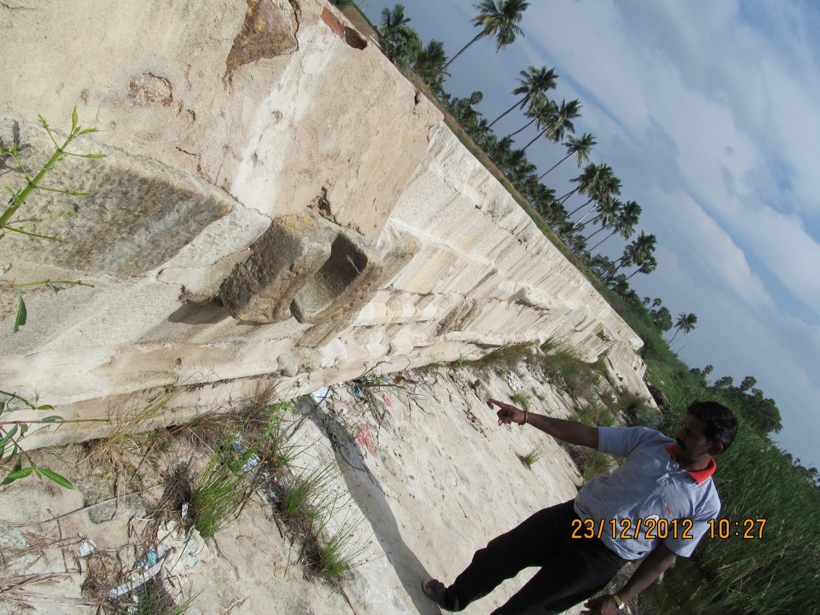

The epigraphic panel of the ruined temple found at the
13th barrage:

The old brick work
structure is beneath the stone structure:

The stagnated pool of water at the 13th barrage:

Ukkirankottai temple parts found in the 12th
river barrage-
at Western Vaalveechu rastha :


The scenic surroundings of the 12th
barrage:


~ ~ : 0 : ~ ~